
Aerial intelligence for construction, energy and infrastructure.
Where Innovation
Meets Infrastructure Expertise
Our aerial mapping services provides a fast, accurate and detailed view of complex sites, structures and environments without the need to physically access every area.
Using advanced drone technology and high-resolution aerial imagery, we capture data that can be transformed into orthomosaic maps, 3D Modelling, measured site plans, georeferenced imagery, area calculations and detailed digital records.
From construction sites and infrastructure to roads, quarries, industrial facilities, utilities, renewable energy assets and heritage environments, our surveys give project teams a clear and measurable understanding of the site.
Services
-

Aerial Drone Mapping & 3D Modelling
Aerial drone mapping and 3D modelling services transform complex sites, structures and landscapes into highly accurate digital datasets that can be measured, analysed and shared.
-

Renewable Asset & Wind Turbine Inspections
Close-proximity aerial inspection of wind turbines, solar installations and energy infrastructure. We identify blade damage, panel degradation and structural concerns without turbine downtime or costly rope access teams.
-

Structural & Scaffold Inspections
Aerial inspections of buildings and infrastructure, identifying defects, damage, and structural concerns with precision.
Detailed aerial monitoring of scaffolding systems to ensure safety, compliance, and proper installation across all site phases.
-

Building & Roof Surveys
High-resolution aerial inspections of roofs and building structures, providing clear visual data for condition assessment and maintenance planning. Thermal and measurement surveys available.
Projects
-
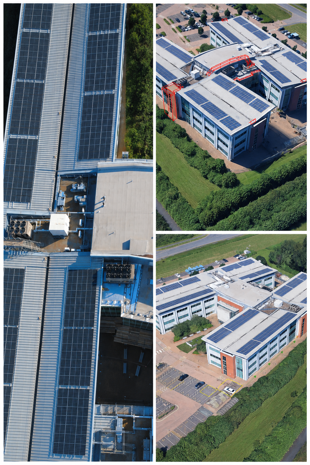
![Aerial survey of a large commercial office complex to support scaffold design and solar panel maintenance planning. The site required detailed visual data across multiple rooftop levels, including hard-to-access areas between buildings. Full rooftop]()
British Gas - Leicester
-
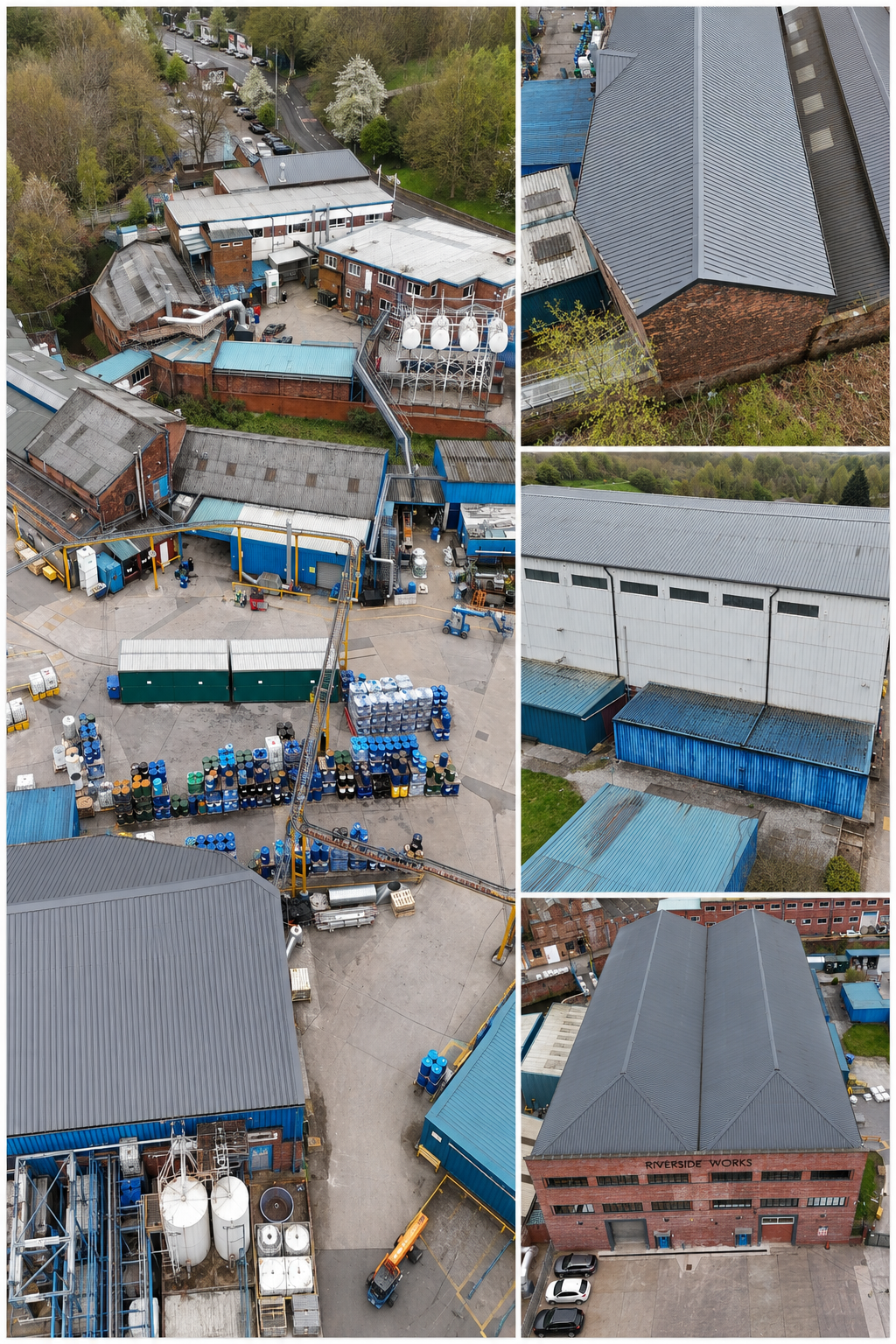
![Industrial site survey of a working paint manufacturing facility on the River Irk, Manchester. The site presented significant access challenges including a riverbed location and multiple hard-to-reach structures. A fully scaled 3D model of the wareho]()
HMG Paints - Manchester
-
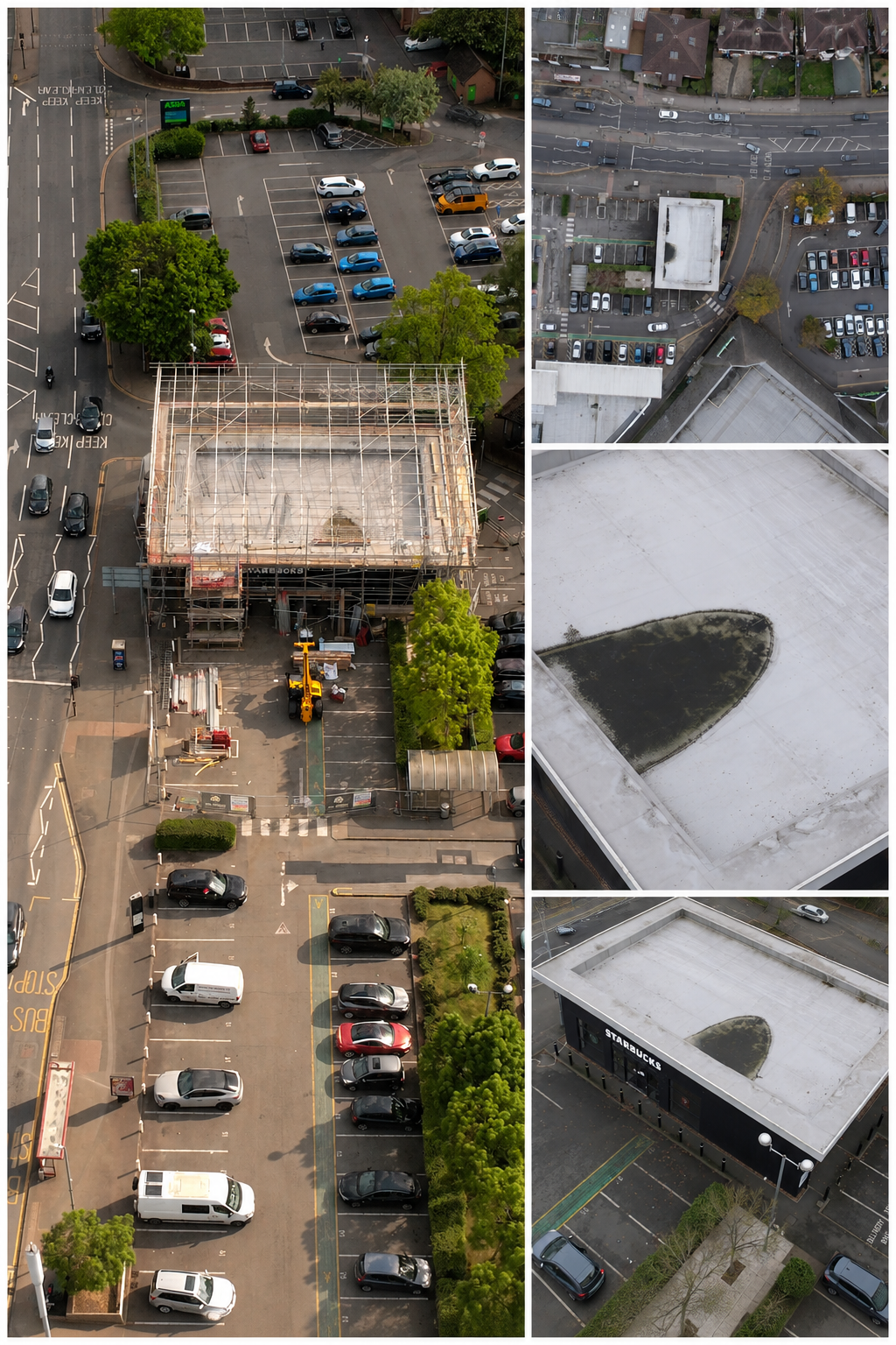
![Progress monitoring survey of a Starbucks construction and roofing project in a busy retail park environment. The site required careful operational planning to fly safely in a high-footfall public location.]()
Starbucks - Northampton
-
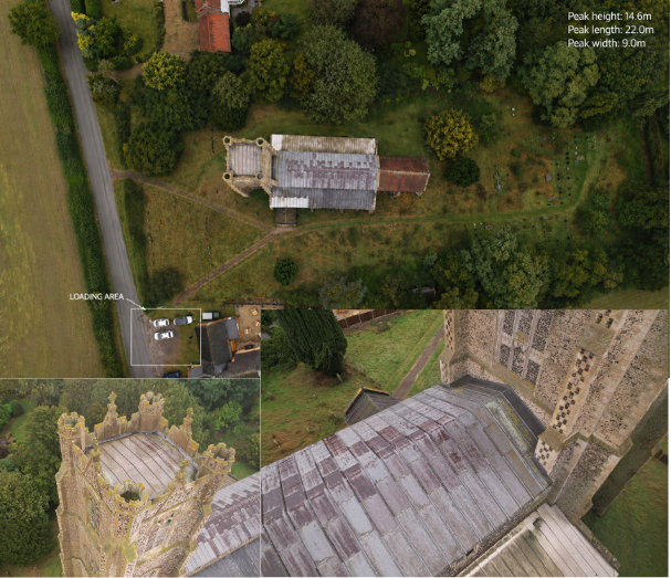
![Heritage aerial survey of a Grade-listed rural church undergoing active restoration works. The site required sensitive logistics planning to allow works to proceed while respecting the surrounding graveyard and public access routes.]()
St Andrew's Church — Deopham Norfolk
-
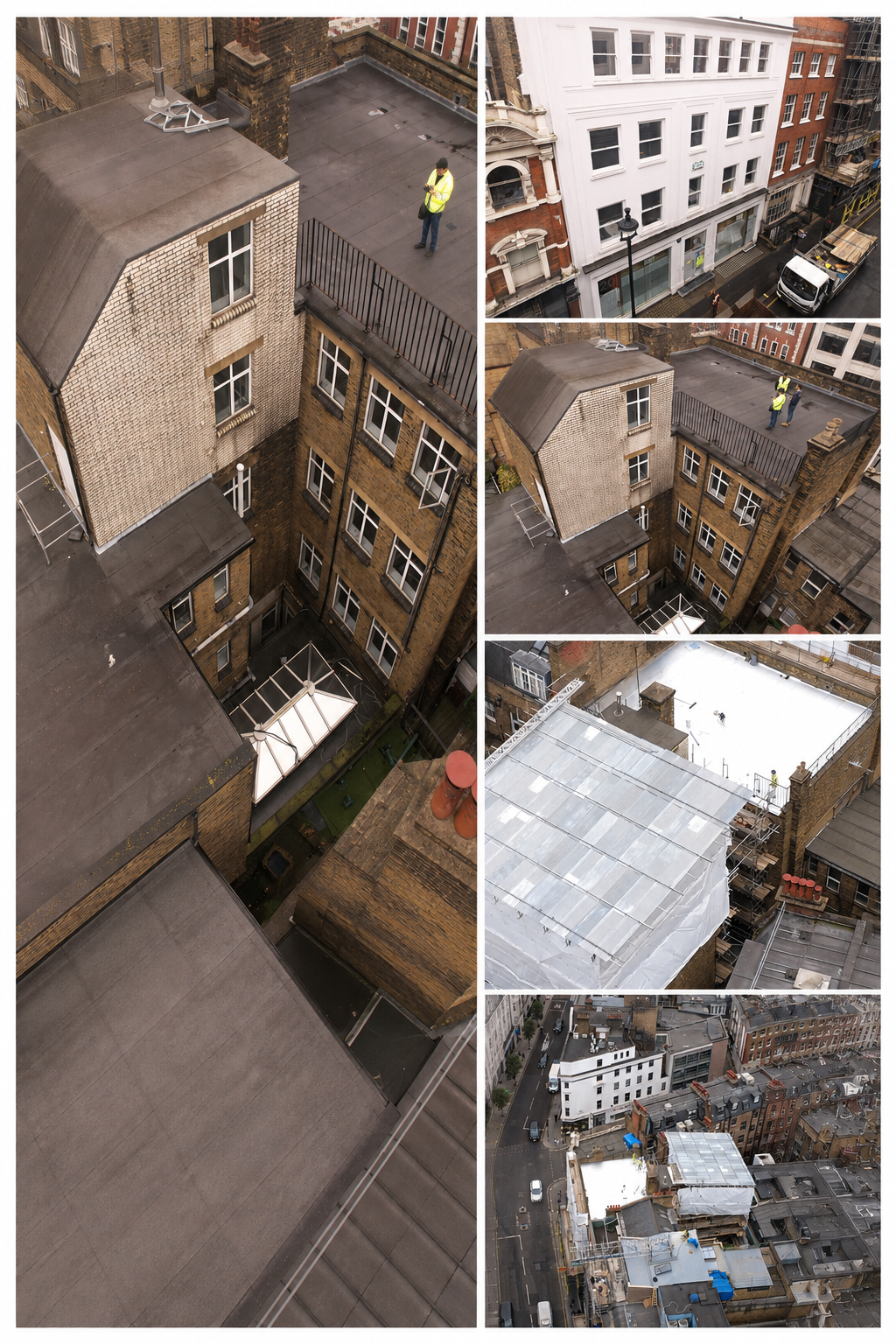
![Facade and rooftop inspection survey of a multi-storey commercial building in central London, W1. The client required a full condition survey ahead of external scaffold design — in a location where traditional access methods would have cost an estima]()
Mortimor Street — Central London
-
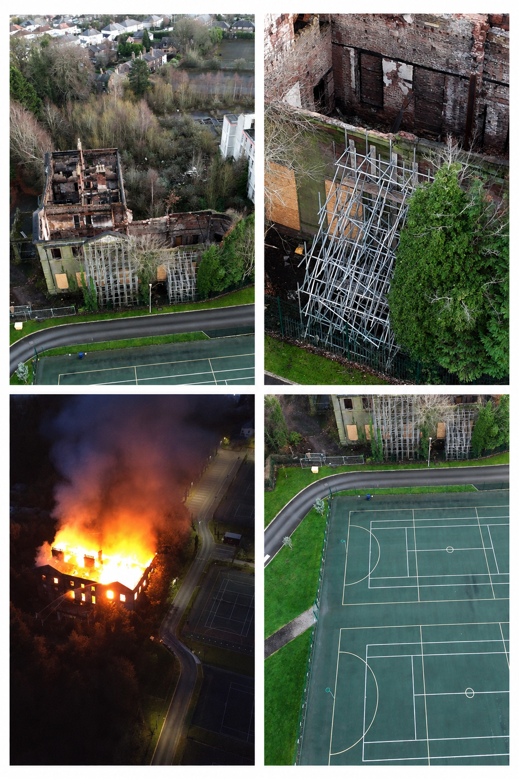
![Aerial survey of Woolton Hall, a Grade II* listed Georgian mansion, following significant fire damage. The client required detailed visual data of the fire-affected roof structure and surrounding site to inform scaffold design for the restoration pro]()
Woolton Hall — Liverpool
-
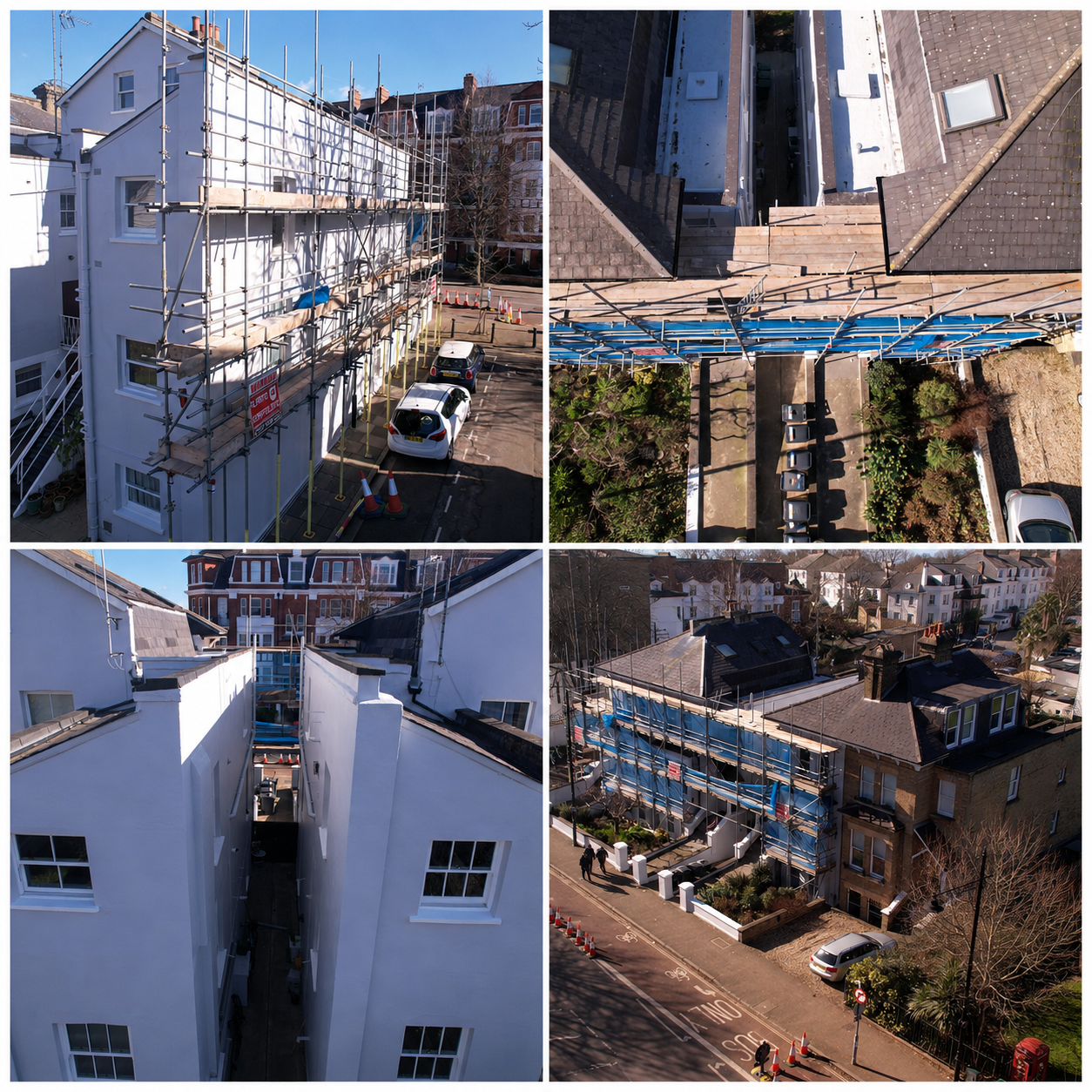
![Rapid mobilisation within 24 hours of incident Full aerial documentation of scaffold installation, site access and works progress Timestamped photographic evidence provided for legal and insurance teams]()
Barnes - West London
-
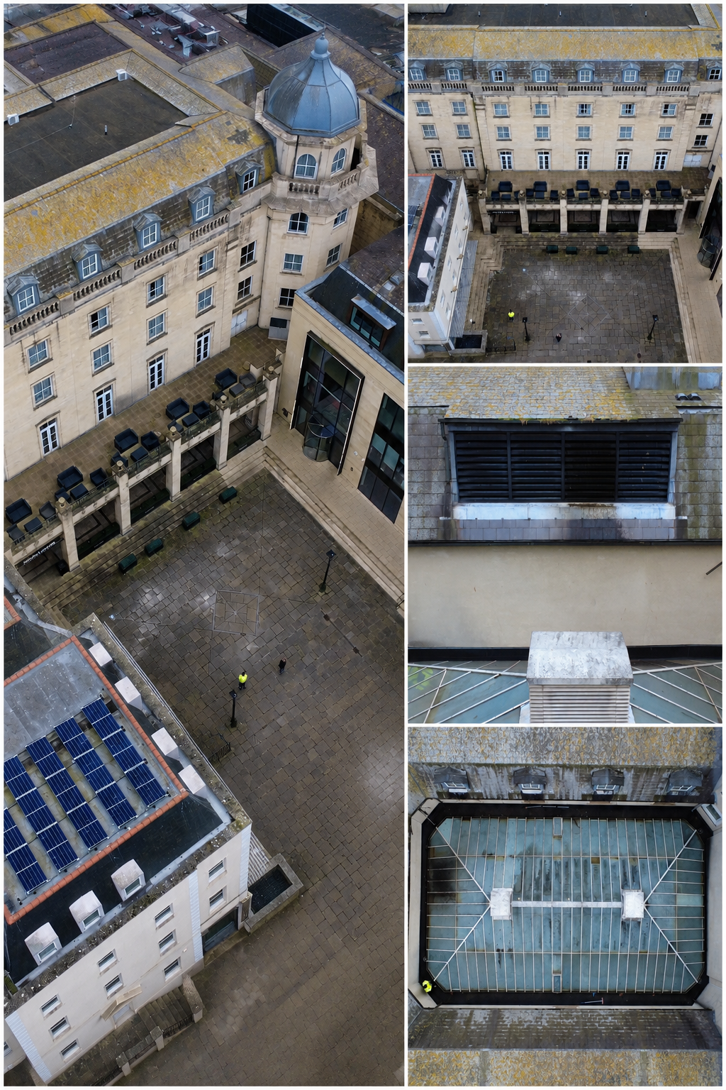
![Comprehensive aerial survey of a landmark Victorian hotel in Bristol city centre, commissioned to support a major roof repair programme. The project required two distinct phases of aerial work — an external condition survey of the building's complex]()
Marriott Hotel - Bristol
About DCS
We believe the future of construction is safer, smarter and built on better information.
Drone Construction Surveys combines over 20 years of experience across construction, surveying, media production and commercial drone operations to deliver advanced aerial data and reality-capture solutions.
Using drone technology, aerial mapping, 3D modelling, LiDAR, thermal imaging and digital data capture, we help project teams understand their environments with greater accuracy while reducing unnecessary risk and difficult access.
We operate nationwide across the UK, Dubai and Saudi Arabia supporting construction, infrastructure, renewable energy, heritage and industrial projects.
We turn the physical world into usable data.
Better information. Better decisions. Safer, more efficient projects.